Monday, 7 May 2012

Day 10: Punta Arenas and Fort Bulnes, Chile


Monday, March 26, 2012
Punta Arenas, Chile


This was to have been the day that we took our field trip into the Patagonia countryside to see guanacos  (undomesticated cousins of llamas and alpacas), rheas (South American ostrich), and a penguin rookery. However, the bad weather of the previous week had sent the penquins on their way . . . . With last minute planning by Teresa, Revell and our local guide, we managed to have a great day, nonetheless.
We started with a brief tour of the city of Punto Arenas, stopping at a viewpoint overlooking the city. 


I loved the soft colors of the buildings and roofs.


Why does laundry look more appealing when it is someone else's?

A couple of vendors had set up some tables and several of our company bought alpaca sweaters.


<><> <><>
A sweet little one wrapped snugly for the cold wind.

<><>
George went for the penguin hat,
which we all felt suited him well!
We stopped for lunch at El Galpon del Estrecho (The Shed of the Stretch), a lovely, rustic farm site that served us a wonderful meal of barbecued lamb accompanied with beautiful salads and breads.

<><>
The fire felt wonderfully warm.

<><> <><> <><>
The cook, cutting up the barbequed lamb.
<><>
This photo, from El Galpon's website,
shows a lunch buffet much like ours.
Thanks for the link, Donald.


After a leisurely lunch we crossed the pasture to the shearing shed, encountering the family pets.
<><> <><>
One of our hosts, Teresa, Jme, and Betty.
The ewe was obviously used to treats, as she came running.

Fred, Sara, and Noreen waiting for treats?
The little dog was a great herder, moving us through the gates, too.


<><> <><> <><>
Mama and me


In the shearing shed, we saw a demonstratration of the traditional method of sheep shearing.

This looked like very hard work.

Raw wool, ready for cleaning

These are guanaco skins. Our host explained that the government wanted to find out if their wool could be used commercially, but it was found to be inferior.


<><> <><> <><>
This large alpaca pulls a cart, but only for the owner.
It tends to spit at anyone else to tries to harness it.

Upon leaving the farm, we headed by bus for a 40 minute drive to Fort Bulnes. On orders of the Chilean President, Manuel Bulnes, Captain Juan Williams and his crew of  22 disembarked at Punta Santa Ana in 1843, taking possession of the territories of the Strait of Magellan, Patagonia, and Tierra del Fuego. Fort Bulnes was active until 1850, two years after the city of Punta Arenas was built. Chile was forced to give up much of Patagonia to Argentina when it was preoccupied with taking over the productive mining areas of Bolivia.


<><> <><> <><>
There were three different styles of building construction
- sod bricks, just like on the Canadian prairies.
 
Log structures. . .
Note the monkey tree.


The Monkey-puzzle Tree or Monkey Tail Tree is an evergreen tree growing to 40 metres (130 ft) tall with a 2 metres (7 ft) trunk diameter. The tree is native to central and southern Chile and western Argentina, and usually grows only at high elevations. It even tolerates snow. 
This 3rd type of plank construction was perhaps the latest.


Revell thought this cannon would fire several miles out to sea.

The rocky point below Fort Bulnes.

The fort had been restored well, and you could see why it had been regarded as such an important site, on the high ground overlooking the strait in several directions.
We then headed back towards Punta Arenas. Some lucky souls enjoyed 'deep meditation'. Since I can't sleep on a bus, I took a few more photos.
This water purification plant was designed to look like icebergs.


Cormorants from the bus window


Fishing boats awaiting the next crab season.
But the best part of the day was yet to come . . .

*sorry for the diamonds' reappearance. They seem to occur during editing. I guess I'll have to get it right the first time!


Tuesday, 1 May 2012

Day 9: Ushuaia, Argentina

After leaving Cape Horn, we sailed north to enter the Beagle Canal, named after Charles Darwin’s ship. Ushuaia is the southernmost city in the world, at 55˚S. The capital city of Alberta, Edmonton, is located at 53˚N in the centre of the province, and Anchorage, Alaska, and Yellowknife, in Canada‘s Northwest Territories, are located at 61˚N.

The Beagle Canal is a narrow passageway between a group of islands on the southern tip of South America. Ushuaia is located on the large island of Isla Grande de Tierra del Fuego. the dotted line in the lower right of the map (actally the border between Argentina and Chile) runs through the Beagle Canal, past the city of Ushuaia.


Antarctica Passenger Terminal
<>
Ushuaia: End of the Earth

We boarded the bus and headed out to our first stop, Isla Redonda, on the Beagle Canal. This is the most southern post office in the world. You could send a postcard home for only $20.00 US! I chose to buy the postcards and bring them home.


Some of our group walked a little way around the pretty bay. I chose to stalk this bird, trying to get a good photo. He was quite cooperative, but I missed my bigger lens – though I enjoyed not having to carry it around!
<> 
<>
The crested caracara
Quite a striking fellow!

<> 
Not as exotic, but, as our Aussie friend, Marcel,
would say, it still 'makes a pretty picture'.

Our next stop was at Tierra del Fuego National Park.
This park celebrated its 50th anniversary in 2010.
<>
Carolyn, George, Barb and Lloyd
I have a plastic cover over the camera as it was showery.


The vistor's center had a nice little museum upstairs. One of the areas described the indigenous people of the area: the Yahgan and the Alacalufes (Canoe Indians). The daily news published by Holland America says: 'Despite the inclement weather, they wore little or no clothing. Constant fies, which gave the region its name, kept them warm.' Our local guide told us that when the family went out into the channel, the man guided the canoe, the woman dived into the water to hunt for clams and other mollusks, and the child was responsible for keeping the fire going in the canoe!
<>
a photo of an old photo in the museum


The canoes were made of wood and bark.


A life-sized model of a native family


<> <> <> <>
The fire in the canoe, on a base of stones and soil.
We could not imagine being in this climate without clothing, never mind going into the water!
Lake Acigami
<> <>
These beautiful black-necked geese were very far out in the lake -
thus, the blurry photo, much enlarged.


<> <>
George and Lloyd

<> 
<> <>
Lloyd has his earflaps down!
Our tour leader, Theresa, with Lloyd and our local guide.
<> <> <> <>
One of the many volcanic mountains in the area.
Gorgeous!

I don't remember the name of this place, our last stop in the park before heading back into Ushuaia, but it was beautiful. It was hard to choose just a few photos, as the colors and the light were wonderful here.


Looking out at the Beagle Channel again.


We then headed back into Ushuaia, where five of us decided to look for a recommended restaurant for a late lunch. We found it, closed, and ended up in another, where most of us had the most wonderful King Crab soup! The best soup, 'ever, ever, ever'!

Barb, Betsy, Lloyd, Julia, and Jeannie
This photo just arrived today fron Julia - great timing, thanks!


The view of the harbor as we left Ushuaia

At the end of the day, we sailed west following the Canal back into open water before heading inland again, threading through the islands to get to our first stop in Chile at Punta Arenas.


The faint red line shows our route towards Punta Arenas.


Wednesday, 25 April 2012

Day 8: Rounding the Horn!

Late in the afternoon of our fourth day at sea, we reached Cape Horn. We appreciated the efforts of our Captain to get us there in daylight, struggling against the strong headwinds.

Cape Horn is located on Hoorn Island, or Islas Hornos, at 55˚59' South latitude at the southern end of the Tierra Del Fuego achipelago. It marks the north edge of the Drake Passage, the strait between South America and Antarctica. As our home is located very close to 50˚ N, we had travelled a long distance to get there. We were only 800 km or 500 miles from the northern peninsula of Antarctica. (For comparison, the southern tip of New Zealand is 47˚ S.) Wikipedia


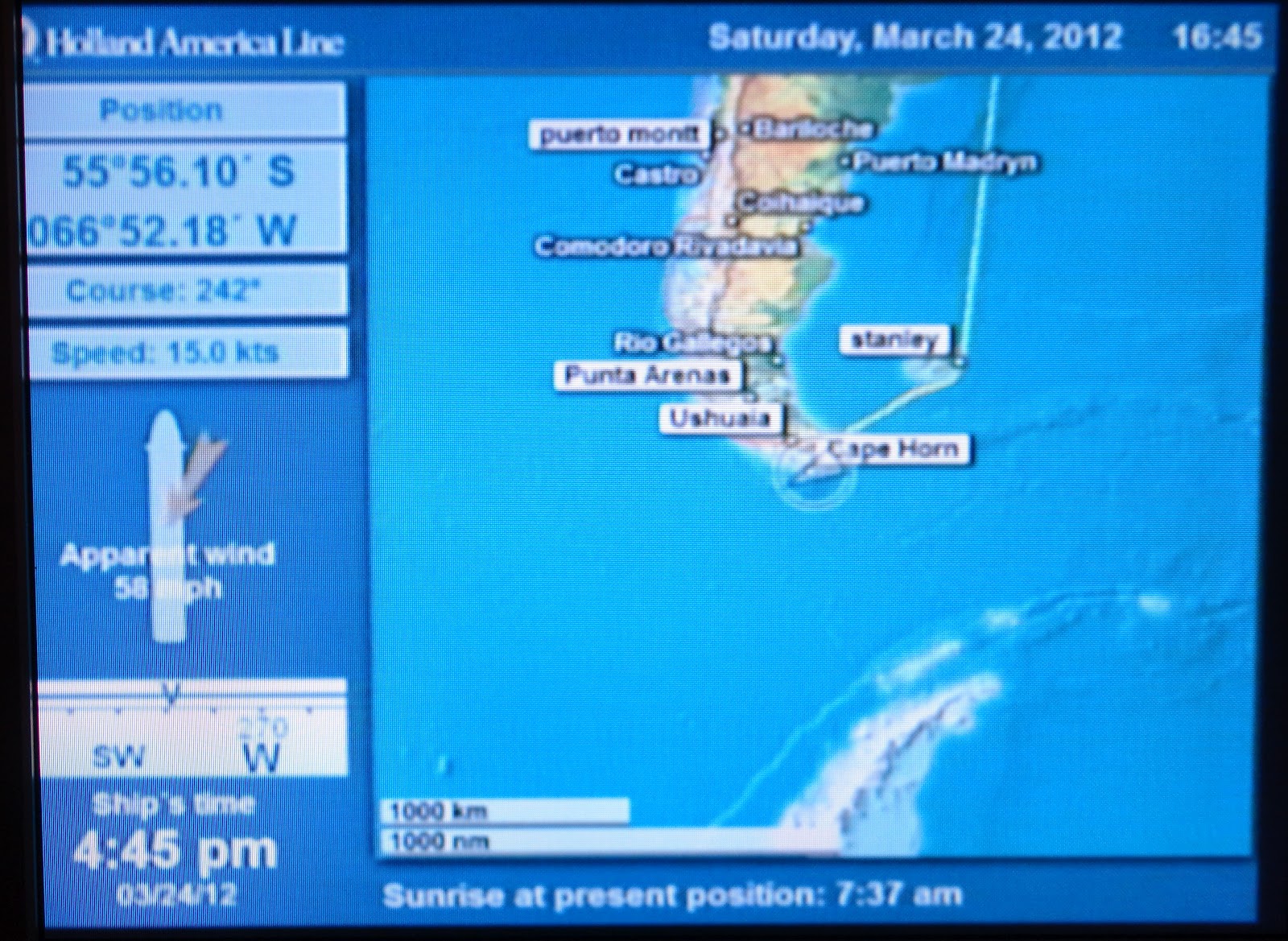
As you can see from this blurry photo of our TV screen in our stateroom, we were experiencing quite strong winds. We slowly circumnavigated the island in a clockwise movement, starting from the southwest, and the weather conditions and light changed from moment to moment, offering lots of different photo opportunities.

Approaching the headland, which rises 1391 ft/422 m.

I think the temperature was about 3˚C and the wind was really blowing, so we look suitably cold in these photos. Once again, we marvelled at the courage of those early sailors in their small boats braving these conditions, the first of whom did so in 1615!


My hood was up and tightly fastened except for this photo!

WikiMiniAtla
It took over an hour, I think, to circle the island, and we then headed northwest to find the Beagle Channel, headed for Ushuaia during the night. Thanks again to Wikipedia, I found out that there is not a weather station on or near Cape Horn. They referred to a study dating from 1882–1883 that reported “an average annual temperature of 5.2 °C (41.4 °F). Winds were reported to average 30 kilometres per hour (19 mph), with squalls of over 100 kilometres per hour (62 mph) occurring in all seasons.” Not a place you’d like to spend a lot of time, but we were excited to be there.


Although there is quite lush vegetation on the island because of the frequent rains, there are no trees at all.
Rain showers and mist meant frequent stops to wipe my lens

very unusual light
The Cape lies within Chilean territorial waters, and the Chilean Navy maintains a station on Hoorn Island, consisting of a residence, utility building, chapel, and lighthouse. Another smaller lighthouse is known as the ‘authentic’ Cape Horn lighthouse; it is the world’s southernmost traditional lighthouse.


It took over an hour, I think, to circle the island, with the wind and skies changing constantly. We then headed northwest to find the Beagle Channel, headed for Ushuaia during the night.