Cape Horn is located on Hoorn Island, or Islas Hornos, at 55˚59' South latitude at the southern end of the Tierra Del Fuego achipelago. It marks the north edge of the Drake Passage, the strait between South America and Antarctica. As our home is located very close to 50˚ N, we had travelled a long distance to get there. We were only 800 km or 500 miles from the northern peninsula of Antarctica. (For comparison, the southern tip of New Zealand is 47˚ S.) Wikipedia
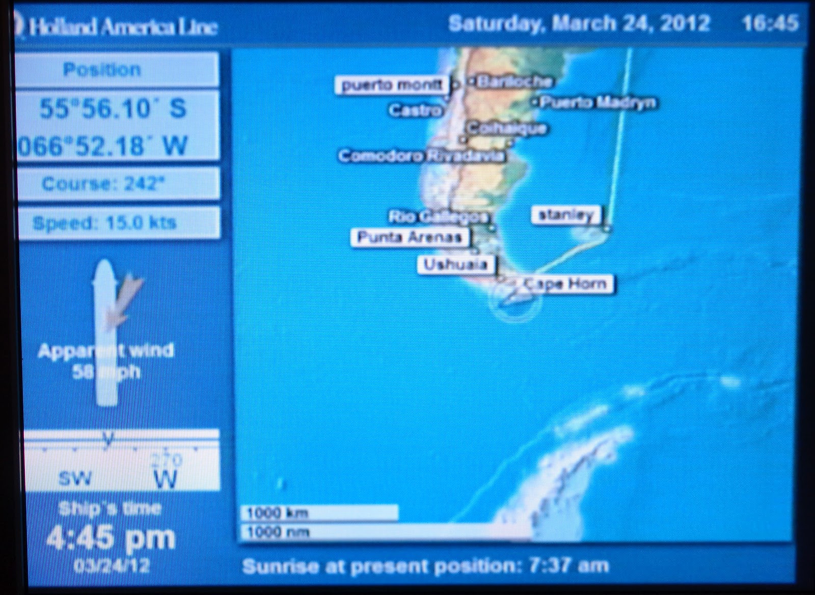
As you can see from this blurry photo of our TV screen in our stateroom, we were experiencing quite strong winds. We slowly circumnavigated the island in a clockwise movement, starting from the southwest, and the weather conditions and light changed from moment to moment, offering lots of different photo opportunities.
 |
| Approaching the headland, which rises 1391 ft/422 m. |
I think the temperature was about 3˚C and the wind was really blowing, so we look suitably cold in these photos. Once again, we marvelled at the courage of those early sailors in their small boats braving these conditions, the first of whom did so in 1615!

 |
| My hood was up and tightly fastened except for this photo! |

Although there is quite lush vegetation on the island because of the frequent rains, there are no trees at all.
 |
| Rain showers and mist meant frequent stops to wipe my lens |

 |
| very unusual light |
The Cape lies within Chilean territorial waters, and the Chilean Navy maintains a station on Hoorn Island, consisting of a residence, utility building, chapel, and lighthouse. Another smaller lighthouse is known as the ‘authentic’ Cape Horn lighthouse; it is the world’s southernmost traditional lighthouse.
 |

It took over an hour, I think, to circle the island, with the wind and skies changing constantly. We then headed northwest to find the Beagle Channel, headed for Ushuaia during the night.

No comments:
Post a Comment